Property Record
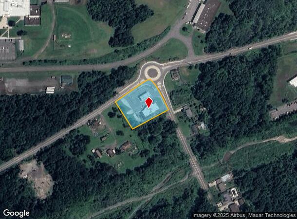
199 Middle Rd, Nanticoke, PA 18634

NEARBY LISTINGS FOR SALE OR LEASE
Property Detail
199 Middle Rd
Scranton--Wilkes-Barre--Hazelton, PA
ESPY ST
42-K7S6-003-002-000
Luzerne
Supermarket
Pennsylvania
X
2
42079C0353F
1.16 AC
2025
I-81 Corridor
2025
Philadelphia
214300
DEMOGRAPHICS near 199 Middle Rd
1 Mile
3 Mile
5 Mile
2024 Total Population
6,651
20,236
44,014
2029 Population
6,683
20,390
44,292
Pop Growth 2024-2029
+ 0.48%
+ 0.76%
+ 0.63%
Average Age
41
42
42
2024 Total Households
2,821
8,628
18,561
HH Growth 2024-2029
+ 0.46%
+ 0.78%
+ 0.65%
Median Household Inc
$55,860
$55,170
$56,234
Avg Household Size
2.30
2.30
2.30
2024 Avg HH Vehicles
2.00
2.00
2.00
Median Home Value
$90,098
$108,214
$106,442
Median Year Built
1948
1949
1949
Nearby Places
Map Layers
Map Styles
 Street
 Aerial
- Restaurants
- Banks
- Shops
- Fitness
- Groceries
PUBLIC TRANSPORTATION
AIRPORT
Wilkes-Barre/Scranton International
DRIVE
WALK
Distance
Wilkes-Barre/Scranton International
30 min
18.9 mi
Nearby Properties
Address
Land Use
TOTAL SIZE
Lot Size
Zoning
Address
Land Use
TOTAL SIZE
Lot Size
Zoning
120.48 AC
Address
Land Use
TOTAL SIZE
Lot Size
Zoning
81.97 AC
Address
Land Use
TOTAL SIZE
Lot Size
Zoning
116.06 AC
Address
Land Use
TOTAL SIZE
Lot Size
Zoning
30.07 AC
Address
Land Use
TOTAL SIZE
Lot Size
Zoning
Address
Land Use
TOTAL SIZE
Lot Size
Zoning
Address
Land Use
TOTAL SIZE
Lot Size
Zoning
89.76 AC
Address
Land Use
TOTAL SIZE
Lot Size
Zoning
Address
Land Use
TOTAL SIZE
Lot Size
Zoning
82.78 AC
Address
Land Use
TOTAL SIZE
Lot Size
Zoning
Address
Land Use
TOTAL SIZE
Lot Size
Zoning
72.94 AC
Address
Land Use
TOTAL SIZE
Lot Size
Zoning
38.87 AC
Address
Land Use
TOTAL SIZE
Lot Size
Zoning
Address
Land Use
TOTAL SIZE
Lot Size
Zoning
1.32 AC
Address
Land Use
TOTAL SIZE
Lot Size
Zoning
Address
Land Use
TOTAL SIZE
Lot Size
Zoning
19.53 AC
Address
Land Use
TOTAL SIZE
Lot Size
Zoning
Address
Land Use
TOTAL SIZE
Lot Size
Zoning
Address
Land Use
TOTAL SIZE
Lot Size
Zoning
4.74 AC
Address
Land Use
TOTAL SIZE
Lot Size
Zoning
Address
Land Use
TOTAL SIZE
Lot Size
Zoning
7.98 AC
Address
Land Use
TOTAL SIZE
Lot Size
Zoning
11.50 AC
Address
Land Use
TOTAL SIZE
Lot Size
Zoning
Address
Land Use
TOTAL SIZE
Lot Size
Zoning
11.29 AC
Address
Land Use
TOTAL SIZE
Lot Size
Zoning
0.07 AC
Address
Land Use
TOTAL SIZE
Lot Size
Zoning
10.32 AC
Address
Land Use
TOTAL SIZE
Lot Size
Zoning
Address
Land Use
TOTAL SIZE
Lot Size
Zoning
45.11 AC
Address
Land Use
TOTAL SIZE
Lot Size
Zoning
1.31 AC
Address
Land Use
TOTAL SIZE
Lot Size
Zoning
18.19 AC
The World's #1 Commercial Real Estate Marketplace
Connect with us
© 2026 CoStar Group
The information above has been obtained from sources believed reliable. While we do not doubt its accuracy we have not verified it and make no guarantee, warranty or representation about it. It is your responsibility to independently confirm its accuracy and completeness. Any projections, opinions, assumptions, or estimates used are for example only and do not represent the current or future performance of the property. The value of this transaction to you depends on tax and other factors which should be evaluated by your tax, financial, and legal advisors. You and your advisors should conduct a careful, independent investigation of the property to determine to your satisfaction the suitability of the property for your needs.